Items filtered by date: January 2026
Satellite images
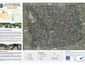
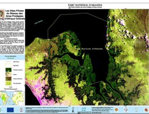
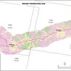
OSFAC maintains a database of satellite imagery for the Congo Basin and distributes this data upon request. The database contains images of varying resolution and is primarily comprised of LANDSAT, ASTER, ASTER GDEM, SRTM, SPOT and LANDSAT MOSAICS images from 1972 to 2014. Data is available in electronic format through the OSFAC office in Kinshasa, DRC and OSFAC focal points. There is no charge for any data distributed through OSFAC, however some data availability is subject to applicable data sharing regulations. For additional information on specific data sharing conditions, please contact us.
Forêts d’Afrique Centrale Evaluées par Télédétection
These atlas were produced as a part of the OSFAC initiative “Monitoring the forests of Central Africa using remotely sensed data sets” (FACET in French). FACET is led by OSFAC in collaboration with South Dakota State University and the University of Maryland, and supported by USAID CARPE. Additional support was provided by World Resources Institute.
About us
Participants proposed creating OSFAC as a regional forum to address these obstacles, which included: difficulties associated with data acquisition, a lack of permanent training institutions and limited capacity to apply satellite information. OSFAC was launched as the GOFC-GOLD network for Central Africa under the Global Terrestrial Observing System (GTOS).
Its primary objective is to support the management of natural resources and promote sustainable development by producing reliable land cover products, distributing satellite data, building capacity and providing technical assistance to partners. Read more
For further information or if you have any questions please do not hesitate to contact us.
Our Team
Dr. Landing Mané
Program Manager
Directeur de l’Observatoire Satellital des Forêts d’Afrique Centrale (OSFAC) depuis 2009. Il a 20 années d’expérience dans divers domaines, notamment, sciences du sol et agriculture, ...
André Mazinga
GIS and RS Officer
Ingénieur Agronome formé à l'Université de Kinshasa. En 2005, Il obtint son diplôme en agronomie dans la filière Gestion des Ressources Naturelles, option Faune et Flore ...
Eddy Bongwele
GIS and RS Senior Officer
Ingénieur Agronome spécialiste en Systèmes d'Information Géographique et télédétection appliquées en gestion des ressources naturelles. Il a travaillé avec OSFAC ...
Cédric Singa
GIS and RS Specialist
Ingénieur Agronome, filière Gestion des Ressources Naturelles à l'Université de Kinshasa en 2008. Il fréquente l'OSFAC depuis 2009 d'abord comme GIS Trainer puis GIS Consultant ..
Bob Boseko
DBA and Software Developer
Licencié en Génie Informatique de l'Universite de Kinshasa. Il est specialiste en developpement des applications web, Desktop, et Mobile. Il a intégré OSFAC en 2011 ...
Serge Kalawu
GIS and RS Officer
Ingénieur en Sciences Agronomiques, spécialisé en Gestion des Ressources Naturelles, filière Faune et Flore a l'Université de Kinshasa. En 2010, il a travaillé avec l’Union Européenne ...
Hervé Kashongwe
Moabi Coordinator
Ingénieur Agronome et intègre OSFAC en février 2011 comme stagiaire professionnel puis comme Assistant SIG, une année après avoir obtenu son diplôme, avec une spécialisation ...
Nancy Kabuya
Administrative secretary and Cashier
Licenciée en Gestion Financière et Marketing de l'Université William Booth (Promotion 2008). Après l'obtention de son diplôme de licence, elle a travaillé comme stagiaire professionnel ...
Micheline Nanzigi
Accounant
Licenciée en sciences économiques et de gestion, option gestion financière de l'Université de Lubumbashi, Micheline KALUMUNA a également un diplôme de qualification en ...
Didier Kyony
Business Development Consultant
Ingénieur a l’Université du Witwatersrand à Johannesburg en 1999 et cela a été suivi par un parcours professionnel de 15 ans en Afrique du Sud. Il a accumulé plus de dix ans d’expertise ...
Guy-Robert Kayembe
Logistician and Driver
Diplôme de graduat en Radionavigation (aviation civile) de l'Institut Supérieur des Techniques Appliquées (ISTA) depuis 2006. Pendant une année, il a occupé le poste de Chef de dépôt ...
Eric Lutété
GIS and RS Trainer
Ingénieur Agronome de formation, spécialiste en Gestion des Ressources Naturelles (Faune et Flore) de l’Université de Kinshasa depuis 2009, Eric LUTETE intègre l'OSFAC en 2011 ...
Serge Kalawu
De 2012 à 2013, il intervient comme Consultant en Système d'Information Géographique dans différents organismes implantés en République Démocratique du Congo, notamment USAID-RDC, Rain Forest Fondation UK, RRN (Réseau des Ressources Naturelles). En octobre 2013, il rejoint de nouveau l'OSFAC, cette fois comme employé à temps plein comme Assistant SIG et Télédétection.


